


Our coastlines are in a constant state of evolution. From the expansion of busy commercial harbors to the restoration of eroded public beaches, coastal development projects are essential for economic growth and environmental resilience. However, these projects often take place in high-traffic areas shared by commercial shipping, recreational boaters, and sensitive marine ecosystems. Managing this busy intersection of heavy industry and public use requires clear, reliable communication. This is where the navigation buoy becomes an indispensable tool.
The fundamental purpose of buoys in coastal development is to establish order in a chaotic environment. They act as the safety barriers, detour signs, and environmental guardians that allow complex infrastructure projects to proceed without endangering lives or damaging the ecosystem. Without these floating markers, a dredging operation or a pier construction site would become a hazardous free-for-all.
In this article, we will explore the critical role of buoyage systems in coastal development. We will examine the specific types of buoy used to manage these dynamic sites, their function in protecting marine habitats, and how smart technology is enhancing safety during major waterfront transformations.
The Strategic Purpose of Buoys in Coastal Projects
Coastal development projects differ from open-ocean construction because they typically occur in shallow, congested waters. A harbor expansion might happen alongside a busy ferry terminal, or beach nourishment might take place near a popular swimming spot. In these scenarios, the purpose of buoys is threefold: ensuring public safety, maximizing operational efficiency, and enforcing environmental compliance.
Ensuring Public Safety
The most immediate priority is separating the public from heavy machinery. Dredgers, pile drivers, and crane barges operate with limited visibility and restricted maneuverability. Buoys create a physical exclusion zone, visually warning jet skiers, kayakers, and sailors to keep a safe distance. This visual demarcation is legally significant and vital for preventing collisions.
Maximizing Operational Efficiency
Time is money in construction. Buoys help streamline operations by marking specific corridors for construction traffic. By designating a "construction vessels only" channel, project managers ensure that barges carrying rock or sand can move freely without getting stuck behind leisure craft. This separation of traffic keeps the project on schedule.
Enforcing Environmental Compliance
Coastal zones are often ecologically rich, hosting seagrass beds, coral reefs, or oyster sanctuaries. Development permits usually require strict protection of these habitats. Buoys are used to mark the exact boundaries of these protected areas, ensuring that no anchor is dropped and no propeller churns up the sediment in sensitive zones.
Essential Types of Buoy for Coastal Development
While standard navigational markers are used, coastal projects often rely heavily on specialized markers designed for temporary or specific uses. Understanding the different types of buoy deployed is key to navigating safely around these sites.
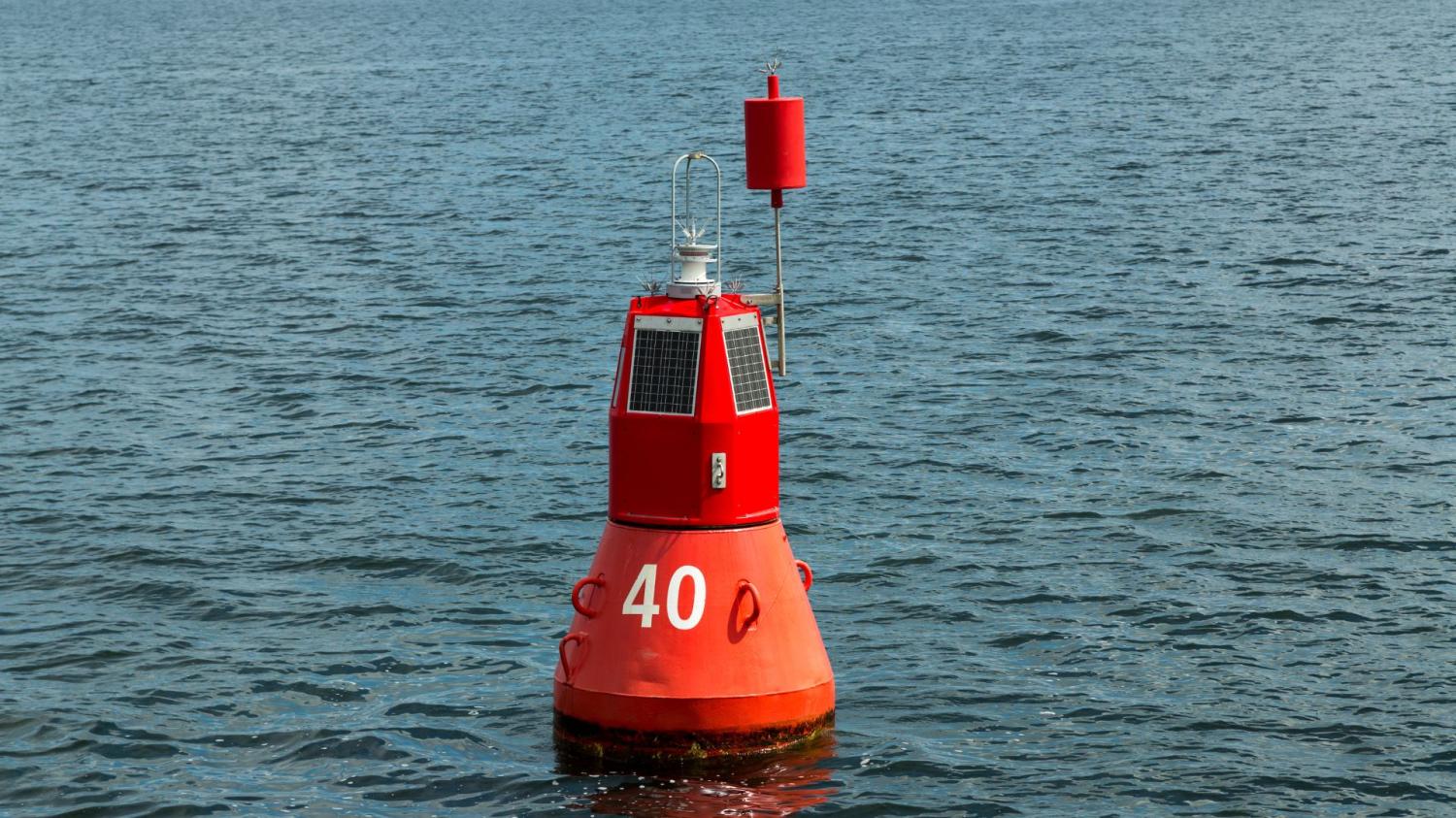
Special-Purpose Buoys (The "Yellows")
These are the most common sight at any coastal construction project.
- Identification: Solid yellow in color, often with an "X" top-mark and a yellow flashing light.
- Specific Role: They are the versatile "caution" signs of the maritime world. In coastal development, they are used to mark the perimeter of the work zone, the location of submerged pipelines (common in beach nourishment), or spoil grounds where dredged material is deposited.
- Why they matter: When a mariner sees a line of yellow buoys, the message is clear: "Special conditions exist here; proceed with extreme caution or stay out."
Lateral Markers (Red and Green)
During harbor expansions or channel realignments, the "road" itself changes shape.
- Identification: Red and green buoys (colors depend on the IALA region) that mark the edges of the navigable channel.
- Specific Role: As dredging widens a channel, the permanent lateral markers must be moved. Often, temporary lateral buoys are deployed to mark the new channel limits while the permanent infrastructure is being built.
- Why they matter: They ensure that deep-draft commercial vessels stay in the newly dredged deep water and avoid running aground on the channel banks.
Cardinal Markers
Coastal development often creates temporary underwater obstructions, such as coffer dams or submerged foundations.
- Identification: Black and yellow horizontal bands with distinct double-cone top-marks.
- Specific Role: These indicate the direction of safe water relative to a hazard. For example, if a new breakwater is being built extending from the shore, a West Cardinal buoy might be placed at its tip to tell boaters to pass to the west of the construction.
- Why they matter: They provide directional guidance, helping vessels navigate around obstacles that may not yet appear on their GPS charts.
Regulatory and Information Buoys
These are common in projects near public recreational areas.
- Identification: White with orange geometric shapes (diamonds, circles).
- Specific Role: A white buoy with an orange diamond containing a cross means "Boat Exclusion Area." These are frequently used during beach nourishment projects to keep swimmers and small boats away from the high-pressure sand discharge pipes.
- Why they matter: They translate complex maritime regulations into simple visual commands that are easily understood by the general public, not just licensed captains.
Specific Applications in Coastal Projects
Different development activities present unique hazards, requiring tailored buoyage strategies.
Beach Nourishment and Restoration
Restoring eroded beaches involves pumping sand from offshore onto the coast via massive pipelines. Some of these pipes float on the surface; others run along the seabed.
- The Buoy Solution: Marker buoys are attached along the length of floating pipelines to make them visible to boaters, preventing fatal collisions. "Pipe Crossing" buoys mark where submerged pipes cross navigable channels, warning vessels not to drag anchors or trawling nets.
Harbor Deepening and Expansion
Deepening a port allows for larger container ships but involves massive dredging equipment operating in the main channel.
- The Buoy Solution: A "rolling" buoy system is often used. As the dredger moves forward, the lateral buoys are progressively relocated to reflect the new channel width. Special-purpose buoys surround the dredger itself to protect its anchor cables, which can extend hundreds of feet outward.
Marina and Pier Construction
Building structures over the water involves divers, cranes, and temporary pilings.
- The Buoy Solution: Exclusion zone buoys create a hard perimeter around the pier. If divers are working on underwater foundations, specific "Code A" flags or buoys must be displayed to mandate a "slow, no wake" speed for passing traffic to prevent injury to the workers below.
Technology Integration and Strategic Placement
Modern coastal development relies on precision. The placement of buoys is no longer just an estimate; it is a calculated engineering decision.
Real-Time Turbidity Monitoring
Environmental protection is a major component of modern coastal permitting. Smart buoys equipped with turbidity sensors are placed around dredging sites.
- How it works: These buoys measure the amount of sediment suspended in the water. If the cloud of silt (turbidity plume) exceeds legal limits and threatens nearby coral or seagrass, the buoy sends a real-time alert to the project manager, who can pause operations until the water clears.
GPS and Virtual AIS Aids
In fast-moving projects, physical buoys are sometimes supplemented by virtual ones. Using Automatic Identification System (AIS) technology, project managers can project a "virtual buoy" onto the electronic charts of passing ships.
- How it works: While a physical yellow buoy marks the corner of a construction zone, a virtual AIS signal ensures that the captain of a massive cruise ship sees the hazard on their screen miles before they can see the physical buoy with their eyes.
Conclusion
Coastal development projects are the bridge between our land-based economy and the maritime world. Whether expanding a port to welcome global trade or rebuilding a beach to protect a community from storms, these projects are vital. However, they introduce significant risks to a shared waterway.
The purpose of buoys in this context is to mitigate that risk through clear, standardized communication. By utilizing the correct types of buoy—from the restrictive regulatory markers to the informative cardinal buoys—project managers ensure that progress does not come at the cost of safety. As technology evolves, these floating sentinels are becoming smarter and more integrated, ensuring that our coastlines can be developed efficiently, safely, and responsibly.