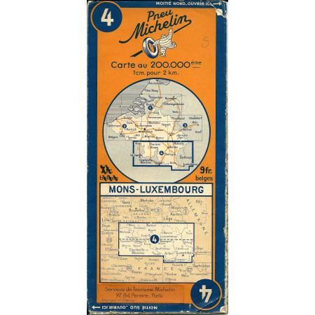
This interesting map was produced by the Michelin tire company as part of its guidebook series "Guides et Cartes Michelin des Champs de Bataille". It covers the areas of Mons and Luxembourg in Belgium and Luxembourg during the Second World War in 1940. The map shows the main roads, railways, and towns in the region, as well as the location of important landmarks such as bridges, fortresses, and military camps. The map also includes annotations and symbols indicating the movement of troops and the locations of battles and skirmishes during the 1940 German invasion of Belgium and Luxembourg. This map serves as an excellent visual aid for understanding the military strategies and movements during this pivotal moment in history. It also provides a unique perspective on the landscape and infrastructure of the region during this time period. Overall, the Michelin map of Mons-Luxembourg 1940 is a valuable resource for historians, military enthusiasts, and anyone interested in World War II.
menu
menu
Menu
cancel
- arrow_back_iosBacknavigate_nextpersonPersonal
- arrow_back_iosBacknavigate_nextdeveloper_guideCollectibles
- business_centerCompanies
- articleBlogs
- groupCommunities
- video_libraryVideos
- eventEvents
- psychology_altQuestions
- live_helpFAQ


